Showing posts with label dolmen. Show all posts

Thursday, 7 November 2019

Some Japanese and Korean history from 1000-500BC

Dogu figurine from Final Jomon Period
This is a post about Japanese and Korean history from 1000-500BC. I am not an expert on this time period at all and there is much that is still unknown and being discovered by archaeologists but the broad outlines of what I will describe here should be mostly correct. This is a time before writing in this part of the world so the main sources will be entirely archaeological, but I may make some references to later myths and legends.

In Sakhalin and the Kuril Islands, to the north of Japan, there is evidence of hunter-gatherers at this time as well. It is presumed that they were related to the Jomon peoples of Japan but the harsher climates faced by these more northerly peoples limited their numbers. To the south, in the Ryukyu Islands, similar conditions prevailed, with the islands being inhabited by hunter-gatherers who relied primarily on gathering fish, especially shellfish, from the sea. The remains of the shellfish were deposited in large shell-middens that are very useful to archaeologists.

In Japan, the Final Jomon Period cultural period was in progress around the time period of 1000BC. This period sees more elaborate pottery being created, but also sees the beginning of stagnation and population decline. It is possible that the hunter-gatherers of Japan were finally beginning to exhaust the land. This is of course speculation. There could be other reasons for the apparent drop in population. Perhaps the sites that have been excavated have not been representative of the Final Jomon settlements.

Liaoning type
bronze dagger
The cultural phase in Korea around the time of 1000BC was known as the Early Mumun Period. This is another archaeological term, and is named after a particular type of pottery vessel that is quite typical of the time. This period was a gradual evolution from the Late Jeulmun and saw the same trends continue. Agriculture was practiced, but not intensively. Extended families would cultivate a small plot of land to grow some foodstuffs, augmenting their diet with hunter-gathering and fishing. Once the land had been exhausted they would move on to another patch of land nearby. This type of agriculture did not permit high population levels so the Korean Peninsula was still fairly sparsely populated.

After a number of centuries the farming practices changed to allow small villages to emerge, which were then probably ruled by chieftains. The important people of these villages began to be buried in megalithic graves. In certain ways, Korea looked quite similar to the Late Neolithic in parts of Ireland, or other parts of Europe or Asia, and one of the types of grave, the dolmen grave, would be seen in Korea as well. Korea would go on to have the largest concentration of dolmens in the world but this would happen later.

Not much more can be said for the next few centuries save that around the century of the 1000’s BC, a Chinese prince is said to have come to Korea. Supposedly a descendant of the conquered Shang Dynasty, named Jizi in later Chinese records or Gija in later Korean records, came to Korea. He was then said to have either founded a kingdom named Gija Joseon or to have been granted lands by the Gojoseon ruler. Gija was said to have brought Chinese learning, culture and technology to Korea. Later Korean writers have disagreed with this on nationalist grounds, arguing that this story was a later legend that was meant to bring Korea under the hegemony of China. This might well have been the case. But the main thing to remember is that there is no archaeological evidence of either the Gojoseon or the Gija Joseon kingdoms at this time.

Dolmens in Korea
Around the mid-900’s BC bronze implements and weapons appear in Korea and the Bronze Age in the region is generally dated to around this time. However, it is not clear if this new metalworking technology brought any political centralisation. There is no real evidence for the kingdoms that are said to flourish in Manchuria and the northern regions of the Korean Peninsula at this time.

Around the year 900BC some believe that the Yayoi people came to Japan. The Yayoi were farmers who brought wet-rice agriculture to Japan. They probably came from outside the Japanese archipelago, most probably from the southern part of the Korean Peninsula. However, it is far from certain that the Yayoi were in Japan at this point. The more traditional date for the beginning of the Yayoi Period is 600 years later, and I am somewhat sceptical that the original dates could have been so wildly wrong. I do not think the Yayoi people were yet in Japan at this point, but I did want to mention that there is a possibility that they might have been.

Dolmen in Korea
Around the mid-800’s BC, the Early Mumun Period in Korea ended and the Middle Mumun Period began. The Middle Mumun Period saw large scale agricultural output and wet-rice farming. The social elites were now buried under dolmen tombs. The Korean Peninsula holds more dolmens than any other similarly sized region on earth. Bronze and jade artefacts were buried with these elites.

The period is also sometimes known as the Songguk-ri Period, after excavations at an important site, called Songguk-ri. This is the type-site for the Middle Mumun Period and seems to have been the headquarters of a chieftain. The settlement was protected with a wooden palisade, suggesting that warfare was known at this time.

Around the century of the 700’s BC the Liaoning Bronze Daggers are found in the regions of eastern Manchuria and the Korean Peninsula. These were daggers that were held as high status items by the cultures in the region. They appear to be locally produced rather than imported and their early distribution roughly matches the conjectured boundaries of the later kingdom of Gojoseon, suggesting that the Gojoseon kingdom may have been in at least partial existence at this time.

Dolmen in Korea
According to traditional Japanese history the first Japanese emperor, Jimmu Tenno, began to regin in the year 660BC. He is said to have ruled until his death in 585BC. This information is taken from a much, much later work called the Kojiki. There is no contemporary evidence of his existence and the archaeological context does not support the hypothesis of a society with emperors. It is probable that this time was still in the Final Jomon Period and that agriculture was not yet known on the Japanese islands. Jimmu Tenno is probably legendary, but no harm to mention the traditional dates. Again, it must be noted that there is a dating controversy over the beginning date of the Yayoi Period, with some placing from 1000BC, others at around 500BC, while the previously unanimous date given was 300BC. In theory, if the Yayoi Period was to be dated earlier, it would make the Jimmu Tenno legend more plausible, but it would still be rather unlikely.

Liaoning daggers
Around the mid-600’s BC the Middle Mumun tribal leaders, who buried their dead in dolmens, created a particularly impressive set of dolmens near the present day region of Gochang. This site contains a staggering 442 dolmens.

Around the mid-500’s BC the Middle Mumun Period in Korea is said to have come to an end and replaced by the Late Mumun Period. The Late Mumun Period saw much greater fortifications surrounding the settlements on the Korean Peninsula at this time and it is hypothesised that there was an increase in warfare at this time.

And thus the period comes to a close. The Japanese archipelago was still populated by the hunter-gatherer culture of the Final Jomon Period, although there is speculation that the Yayoi culture had arrived in Japan at that time. In Korea, the Bronze Age had well and truly begun and there are clear signs that the population was becoming urbanised although it is not entirely clear if there were organised kingdoms on the peninsula. It is likely that there was a kingdom called Gojoseon in the northern regions of the peninsula, but it is difficult to prove.

Jomon Period Vase
Related Blog Posts:
Some Japanese and Korean history from 4000-2000BC
Some Japanese and Korean history from 2000-1000BC
Some Japanese and Korean history from 1000-500BC

Sunday, 13 November 2011

Southern Sligo


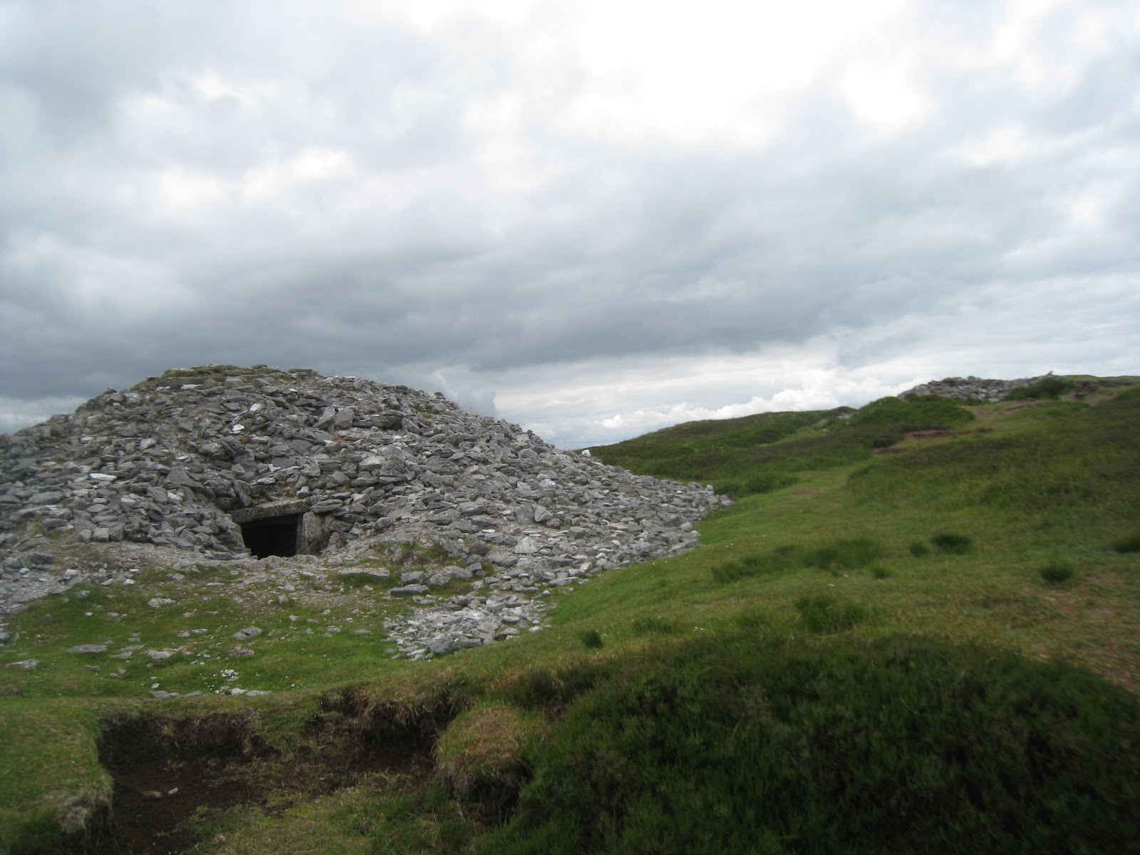
Tomb at Carrowkeel
This blog post is about some interesting archaeological and historical sites in the south of County Sligo in the Republic of Ireland. Ireland has many well-known historical sites such as Tara and Newgrange but sometimes the lesser-known sites are more rewarding to visit.

If one is driving north from the town of Boyle towards Sligo you will see the Bricklieve Mountains on your left. These are not particularly high or remarkable looking mountains and the unwary visitor could easily pass them by without a second thought, but on top of these mountains is the Carrowkeel megalithic tomb complex. 

There are thousands of prehistoric tombs and monuments in Ireland but there are only four complexes of these tombs, where the tombs are grouped together. The most famous complex is in the Boyne Valley, comprised of Newgrange, Knowth, Dowth and a host of other tombs. The Boyne Valley complex is elaborate and by far the largest complex in Ireland but it is not the most ancient as the other complexes, Carrowmore, Carrowkeel and Loughcrew are assumed to predate it. Based on radiocarbon dating, these Neolithic sites are generally given dates ranging from 3500 BC to 3000 BC with Carrowmore as the most ancient and the Boyne Valley as the most recent. It should be remembered that not all the tombs are dated and that these complexes were built over time and used for hundreds of years so there is doubtless considerable overlap.

Tomb G: Note the Roof Box above the entrance.
Despite being more recent than the more ancient site of Carrowmore in the north of Sligo, Carrowkeel bears the distinction of having what appears to be the oldest “roof box” in Ireland. Many of these tombs appear to have been oriented towards particular directions based on astronomical calculations but the roof box allowed the builders to harness this alignment for effect. The roof box was a small window above the main entrance, too small for anyone to enter through. However, if you are lucky enough to be allowed into Newgrange on the morning of the winter solstice (and if the unpredictable Irish weather co-operates) you will see the rays of the rising sun enter the passage and briefly, but brilliantly, illuminate the total darkness of the tomb. Click here for images. The astronomical alignment at Carrowkeel is different; with the roof box aligned to catch the setting sun of the summer solstice but the principle is the same. 

The tombs are signposted from the village of Castlebaldwin along the N4 and can be accessed on foot by paths and on a clear day the views are impressive, however the visitor should be aware that the Bricklieve Mountains have a number of cliffs and sheer drops and wanderings from the path should be done with caution. Tombs that appear deceptively close may in fact lie across a hidden valley. There are over sixteen tombs in the complex. They generally comprise of a single room, entered by a north-facing entrance and covered with a mound of locally quarried quartz. Some have been damaged by amateurish investigation so visitors should be aware not to compound the damage done. The tombs are labelled alphabetically. Tomb G is probably the best preserved and is the tomb that contains the first roof box.

Interior of Tomb G
From this tomb one can see Sligo spread out below, with Knocknarea to the north. Click here for a site containing panoramas from the site. The tombs of Carrowmore are located to the north but I was unable to see them from Carrowkeel. It was however possible to see the prominent cairn of “Queen Maeve’s Grave” on Knocknarea to the north so it is possible that the two Sligo complexes are aligned to each other. To the west can be seen Kesh, another low mountain with tombs atop it. The other side of Kesh, invisible from Carrowkeel, is riddled with caves, which may have had some ritual significance. To the east lies Lough Arrow and the plain, which according to mythology was the site of the Battle of Moytura.

Interior of St Mary's Priory
If you are touring the area it may be worth a trip to the other side of Lough Arrow, where one can find the ruins of St. Mary’s Priory, founded in 1547 AD under the patronage of the McDonagh clan. It was closed down by Henry VIII in his Dissolution of the Monasteries, but the friars continued to live in and around the site until around 1785. The priory is relatively well preserved compared to other similar structures.

Labby Rock
Nearby is the Labby Rock, a large dolmen, the capstone of which is estimated to weigh 65 tonnes. The name “Labby” is transliterated into English from the Irish word “Leaba” meaning “bed”. According to one legend, Diarmaid and Grainne used the capstone as a bed while on their legendary flight around Ireland being pursued by Fionn mac Cumhaill (“Cumhaill” is generally pronounced “cool”). An older legend, based upon the Book of Invasions says that the tomb was of the king of the Tuatha De Danann, Nuada of the Silver Arm. 

View from Carrowkeel over Lough Arrow and Moytura
The area to the west of Lough Arrow is the site of the legendary Second Battle of Moytura. In the legend the Tuatha De Danann were oppressed by a king, Bres. They overthrew Bres and replaced him with their previous king, Nuada. Nuada had previously lost the kingship after losing an arm in single combat and the Tuatha De Danann were not permitted to be ruled by someone with a physical defect. To remedy this Nuada was given an arm of silver to replace the one lost. Bres fled to his kinsfolk across the sea, the Fomorians, who gathered to invade Ireland. The Fomorians were led by their king, Balor of the Evil Eye, whose eye was said to be so huge that it required several warriors averting their gaze and using spears to open it and which caused death to anyone who saw it. Against this awful weapon the Tuatha De Danann had the warrior Lugh of the Spear.

The battle raged for days, with Balor wrecking havoc and Nuada dying on the field until Lugh came within range of Balor and hurled his spear just as the great eye was being opened. The spear slew Balor and knocked him backwards so that the Evil Eye faced backwards into the Fomorian hosts before burning a hole straight into the earth. Decimated by their own weapon, their king dead and attacked by the triumphant Lugh, the Fomorians fled back across the sea. The story is unusual and entertaining as Irish legend usually is. As a student of mythology, Tolkien was doubtless aware of the tale and I have always wondered if the Eye of Sauron had any basis in the person of Balor of the Evil Eye.
Tomb H at Carrowkeel heavily damaged by poor excavation

The Labby Rock is dated to around 2500 BC and so predates all the tales of Moytura but it is interesting that there are so many Stone Age remains in the Sligo area. According to archaeological consensus the first settlement of Ireland was in the south with settlers from northern Spain. While the settlement of Ireland happened long before the Neolithic era, any new technologies from Europe would be most likely to arrive in the south or east of the island, meaning that Sligo, up towards the northwest of the island is an unlikely place for the first concentration of ancient monuments. Why the Neolithic farmers chose this place to first dabble in monumental architecture is something we shall probably never know.